
My Dad shared this article from the North Side Journal from March 2024, Section B Page 15.
People who live in the Magic Valley know there is a Milner Dam near the east end of Jerome County. When the irrigation waters are released in early spring from Milner Dam, the canals flow on the north side and on the south side of the Snake River. But did you know there was an actual town named Milner? And how the town got its name? In the early 1900s, Jerome County farmer I. B. Perrine was transporting his fruits and vegetables from his farm in the Snake River canyon to the Albion Normal School South of Oakley. The trail from the Blue Lakes farm to Albion was a pretty rough ride for his horses and wagon. When he got to what was known as the Cedars, he rode across the river on Starrh’s ferry boat then traveled the rest of the way on another rough trail. He took this route several times and thought there should be a dam here to bring river water up onto the sagebrush areas on both sides. He discussed his thoughts with several of his acquaintances, especially the ones with money to spend on projects like this. He filed paperwork, which was approved in 1903, to own land and water rights in this area and proceeded to get the financing.
When everything was approved, a corporation was formed to build a dam at the Cedars. Peter Kimberly, S. B. Milner, H. L. Hollister, Witcher Jones, Robert McCollum, Paul Bickel, D. C. McWatters, Frank Buhl, and William S. Kuhn all had a hand in the financial end of this project. Before building the dam, canals had to be created on each side of the river.
They started with the south side because the Stricker Stage Stop and some other nearby settlements were already on that side. There were no communities on the north side toward the west which would be the flow of the canals. In order to build canals, there had to be construction workers: so, a town was started on the south side of the Cedars crossing which was named after Mr. Milner. They started with the south side canals flowing west towards where any unused water would flow into Rock Creek just before it dropped into the Snake River. While these canals were built guilt, the town of Twin Falls, named for the twin falls two miles upriver of the Shoshone Falls, was being developed in 1904 near Rock Creek almost 40 miles to the west of Milner. The dam was finished, the gates opened to the south side in 1905. Just after this time, plans were made to create canals on the north side.
The workers from Milner also helped with this construction. We know of all the difficulties the north side had from so much basalt rock that the canal water seeped through, and they had to apply concrete to the first two miles of the canal system in order to get water to the communities west of there. By 1905 the community of Greenwood began to develop on the north side. Most had to shop and bank at Milner, 16 miles away. Many farmers had come to claim free land under the Carey Act. By 1910 the water canal was filling the system and the towns of Hazelton (1911), Eden (1911), and Jerome (1907) had started with canal water flowing through and past them and back down into the Snake River west of Wendell (1907). When the Milner Dam and the canal systems work was finished, the construction workers and business owners and Milner either farmed lands close by on either side or move to other towns.
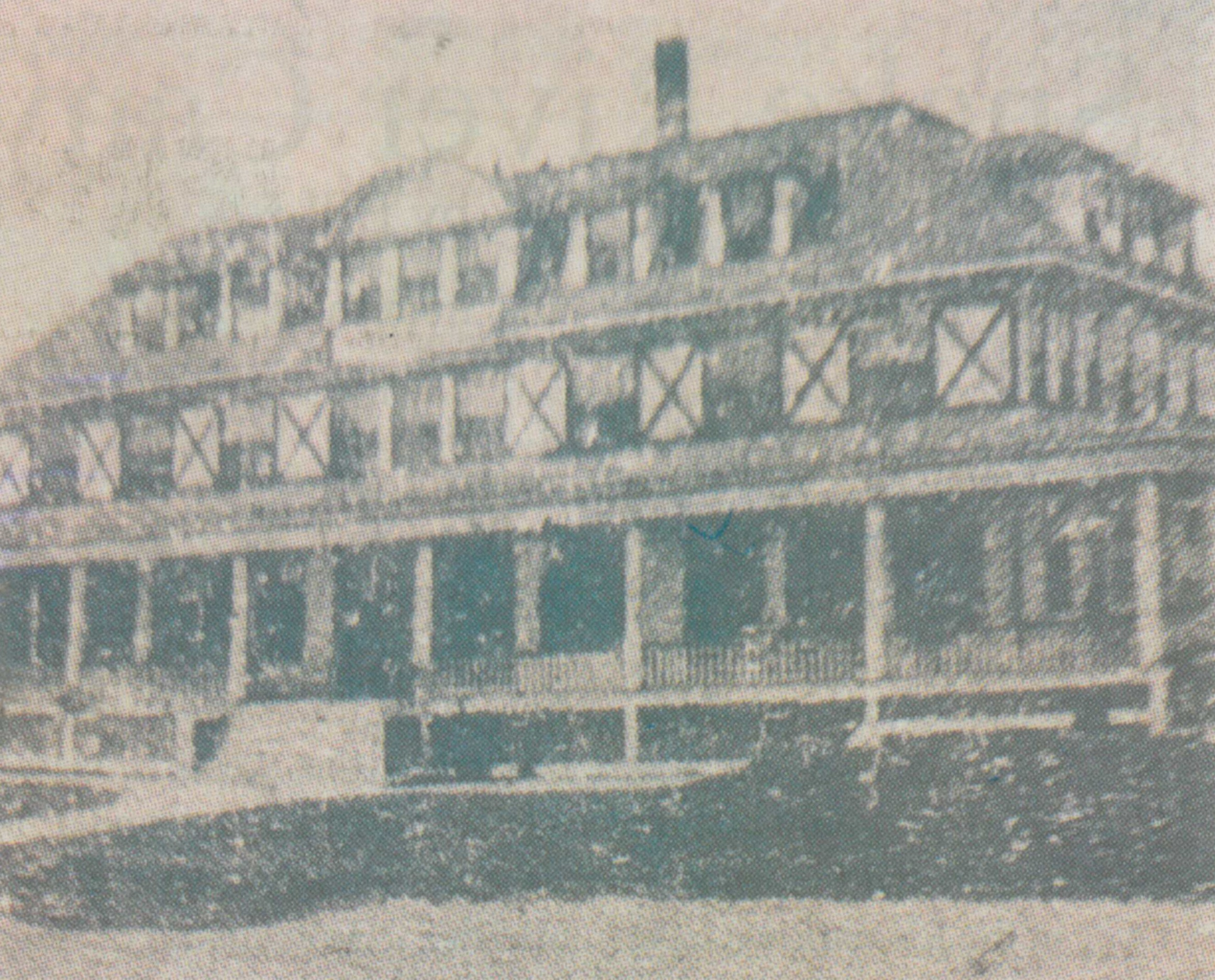
The bank, grocery store, mercantile stores, saloons and “red-light district” moved to Hazelton in 1914, about 16 miles away. The big Riverside Inn burnt down. The only thing left that shows the town of Milner existed is the cement casing that was around the bank vault and a few graves. (Information from North Side News and Helms family history).
